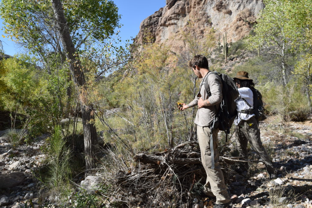
Since 2015, Wild Arizona has been leading an ongoing effort to restore native habitat in Arnett Creek and its tributary, Telegraph Canyon, just outside of the town of Superior, Arizona. Invasive tamarisk (salt-cedar) and oleander plants had infested these canyons, impacting native plant populations, reducing available surface water, and choking out access for hikers and equestrians. Thanks to years of effort by our staff, volunteers and numerous partners, Arnett Creek is on the path to recovery and has become a popular recreational destination with the Legends of Superior Trail traversing much of its length and connecting the town of Superior with the Arizona National Scenic Trail.
You can help us with this project by documenting any living tamarisk or oleander plants that you find in Arnett Creek while hiking, riding or otherwise enjoying this beautiful desert riparian canyon. By loading a free app onto your phone and downloading our Arnett Creek form, it couldn’t be easier to get started!
invasive tamarisk and oleander plants harm native habitat.
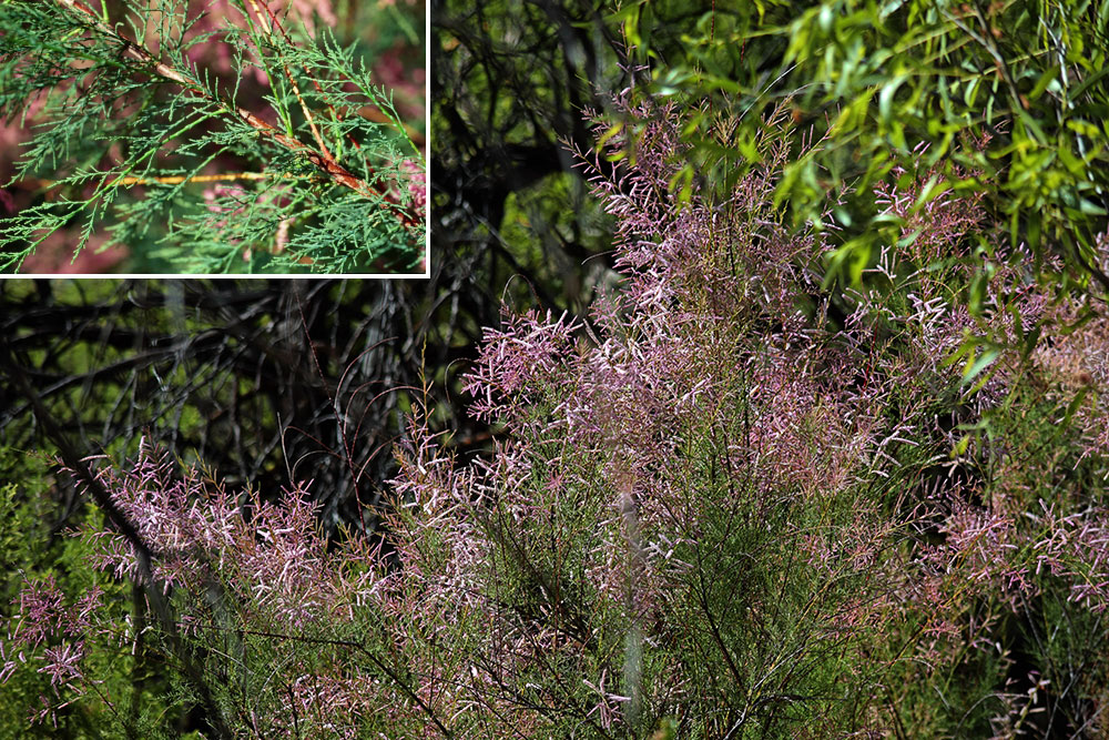
Saltcedar (synonyms: salt cedar, salt-cedar, tamarix, tamarisk) is an invasive plant in the family Tamaricaceae, which has 4 genera with 54 species worldwide. Salt cedar is found in many riparian areas throughout the West. It was introduced in the early 1800’s as an ornamental and for erosion control.
Salt cedars are fire-adapted species and have long tap roots that allow them to intercept deep water tables and interfere with natural aquatic systems. They can also increase the risk of fire in riparian ecosystems through deposition of flammable fuels (Brooks & Minnich in press).
Salt cedar disrupts the structure and stability of native plant communities and degrades native wildlife habitat by out-competing and replacing native plant species, monopolizing limited moisture, and increasing the frequency, intensity and effect of fires. The foliage of tamarisk can add salt deposits to the soil, inhibiting growth of other species (Egan et al. 1993, Brotherson & Field 1987). Although it provides some shelter, the foliage and flowers of salt cedar provide little food value for native wildlife species that depend on nutrient-rich native plant resources (Muzika & Swearingen 2005b, Brooks & Minnich, In press).
Salt cedar is able to use salty water. It does this by absorbing the salts through cell membranes. It avoids the toxic effects by using special glands to excrete the salts and by dropping salt-filled leaves. The leaves dropped each fall accumulate to a considerable depth under the canopy. Through this process, salt cedar acts as a salt pump concentrating salts from deep in the ground onto the soil surface. Over time, salts in the mulch layer kill existing plants and prevent others, especially desirable riparian species, from becoming established. As a result, the ground under a salt cedar or within a salt cedar thicket is void of plants except, on occasion, another salt tolerant species (Johnson et al 2002).
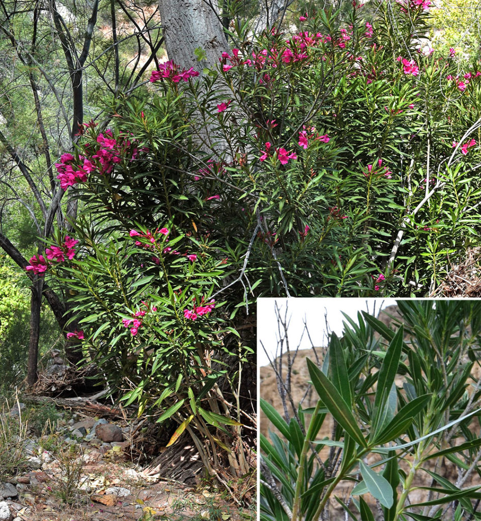
Nerium oleander, most commonly known as oleander or nerium, is a shrub or small tree belonging to subfamily Apocynoideae of the dogbane family Apocynaceae and is cultivated worldwide in temperate and subtropical areas as an ornamental and landscaping plant. It is the only species currently classified in the genus Nerium. It is so widely cultivated that no precise region of origin has been identified, though it is usually associated with the Mediterranean Basin.
get out and get involved.
Ready to get started? Download the free Survey123 app from the iOS App Store or for Android from the Google Play store.
When launching the app, select Continue without signing in at the bottom of the screen.
On your phone, follow this link or scan the QR code below to load the Arnett Creek & Telegraph Canyon Oleander & Tamarisk Monitoring form into Survey123.

While you’re out hiking in Arnett Creek or Telegraph Canyon, if you see any live tamarisk or oleander plants within the project area, open up the app, tap on the Arnett Creek and Telegraph Canyon Oleander & Tamarisk Monitoring form, and either follow the instructions in the form or tap the Collect button to document each plant individually. Be sure to only document living plants—if there’s no evidence of life on the plant, there’s no need to document it!
If you don’t have internet access while monitoring in the canyon, that’s okay—you can collect data even while on airplane mode. It will prompt you to Save in Outbox. When you’re back in service, re-open Survey123, tap the Outbox button at the bottom of the screen, and tap Send to sync all your collected data with us.
Before you head out, download or print our Monitoring Guide and take it with you. This contains detailed descriptions and identification guides for tamarisk and oleander, as well as driving and hiking directions for reaching Arnett Creek. While you’re out hiking, if you see any live tamarisk or oleander plants within the project area, open up the app and document it!